Catalog Archive
Auction 99, Lot 492

"Carte de l'Afrique Francoise ou du Senegal Dressee sur un grand nombre de Cartes Manuscrites et d'Itineraires rectifies par diverses Observations", Delisle/Buache

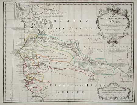
Subject: Africa - Western

Period: 1745 (dated)

Publication:

Color: Hand Color

Size:
24.2 x 18.5 inches
61.5 x 47 cm
Download High Resolution Image
(or just click on image to launch the Zoom viewer)

This impressive, large map covers present-day Senegal and Gambia. The map is colored to show the extents of various tribes and provides extensive detail along the Senegal River. The region was an important center for African trade, especially the slave-trade, and was the site of various battles between the European powers. This map represents the French interests in the region who broke the Portuguese monopoly in the late 16th century and established trading posts along the river. Decorated with large, uncolored, title and scale of miles cartouches. The map was original drawn by Guillaume Delisle and dated 1726. This issue with Buaches' imprint in top margin, dated 1745.

References:

Condition: A+

Estimate: $300 - $350

Sold for: $200

Closed on 6/12/2002

Archived