Catalog Archive
Auction 99, Lot 377
"Etats de Pologne et de Lithuanie, Divises par Palatinats et Provinces Ecclesiastiques avec le Roiaumede Prusse et le Duche de Curlande", Brion de la Tour/Desnos
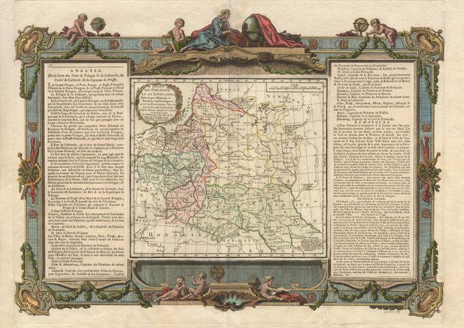
Subject: Poland and Lithuania
Period: 1766 (dated)
Publication: Atlas General, Civil et Ecclesiastique
Color: Hand Color
Size:
22 x 15.5 inches
55.9 x 39.4 cm
Download High Resolution Image
(or just click on image to launch the Zoom viewer)
(or just click on image to launch the Zoom viewer)