Catalog Archive
Auction 99, Lot 329

"The Road From Huntingdon to Ipswich…", Ogilby, John
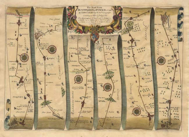
Subject: England

Period: 1675 (circa)

Publication: Britannia

Color: Hand Color

Size:
18.2 x 12.8 inches
46.2 x 32.5 cm
Download High Resolution Image
(or just click on image to launch the Zoom viewer)

John Ogilby's 'Britannia' was published between 1675 and 1698. It is a landmark in the mapping of England and Wales. Its unique format constituted the first national road-atlas of any country in Western Europe. It was composed of maps of seventy-three major roads and cross-roads, presented in a continuous strip-form, on a uniform scale of one inch to a mile. Each beautiful map includes wonderful detail of the countryside with each strip containing a large compass rose to indicate changes in direction.

A graphic map of the road from Huntington to Ipswich, through the towns of St. Ives, Erith, Sutton, Ely, Soham, Bury and Wulpit. Decorative cartouche, coat of arms and compass roses.

References:

Condition: A

Expert repair on centerfold and backed with light Japanese tissue.

Estimate: $300 - $350

Sold for: $220

Closed on 6/12/2002

Archived