Catalog Archive
Auction 99, Lot 31

"Carte Generale de la Terre necessaire au Service de la Marine Stable sur un Plan Fixe Sans Antipodes", Clermont, Jacques
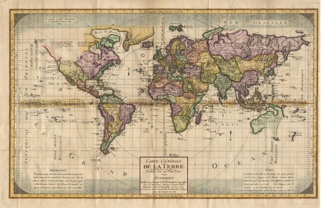
Subject: World

Period: 1780 (circa)

Publication:

Color: Hand Color

Size:
22.8 x 14.1 inches
57.9 x 35.8 cm
Download High Resolution Image
(or just click on image to launch the Zoom viewer)

A very uncommon and fascinating early thematic map featuring the world’s climatic regions. Snow and ice pictorially depict the poles and the Equator is shown as a flaming band. The geography is typical of the late 18th century and notes several recent discoveries. On the northwest coast of North America a notation questioning the supposed discoveries of Admiral de Fuente and the mythical Northwest Passage.

References:

Condition: A

Very minor surface soil along folds, else fine.

Estimate: $1,300 - $1,500

Sold for: $950

Closed on 6/12/2002

Archived