Catalog Archive
Auction 99, Lot 235
"Map of the Lehigh Valley, showing the counties of Northampton, Lehigh, Carbon and Luzerne, also the Lehigh Valley Rail Road, and the Lehigh Canal, Their connection with other Rail Roads and Canals, and the location of the Towns upon them", Anon.
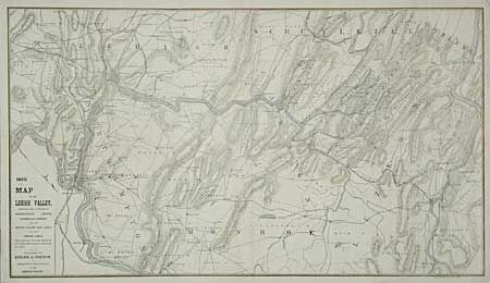
Subject: Pennsylvania
Period: 1860 (dated)
Publication: M.S. Henry's History of the Lehigh Valley
Color: Hand Color
Size:
27 x 15.2 inches
68.6 x 38.6 cm
Download High Resolution Image
(or just click on image to launch the Zoom viewer)
(or just click on image to launch the Zoom viewer)