Catalog Archive
Auction 99, Lot 230
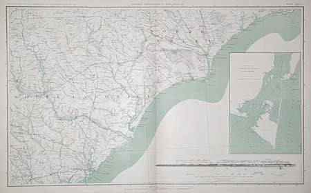
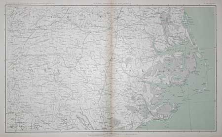
"[Lot of 2] General Topographical Map Sheets III and IV", U.S. War Records Office
1 of 2
Subject: North and South Carolina
Period: 1891 (published)
Publication: Atlas to Accompany the Official Records of the Union and Confederate Armies
Color: Printed Color
Size:
27.4 x 16.5 inches
69.6 x 41.9 cm
Download High Resolution Image
(or just click on image to launch the Zoom viewer)
(or just click on image to launch the Zoom viewer)