Catalog Archive
Auction 99, Lot 142

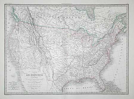
"Carte des Etats-Unis d'Amerique, du Canada, du Nouveau Brunswick et d'une partie de la Nouvelle Bretagne", Lapie, Alexander Emile & Pierre
Subject: Canada & United States

Period: 1854 (dated)

Publication: Atlas Universel de Geographie Ancienne et Moderne

Color: Hand Color

Size:
21.5 x 15.6 inches
54.6 x 39.6 cm
Download High Resolution Image
(or just click on image to launch the Zoom viewer)

A great mid-nineteenth century map issued shortly after the Mexican War and reflecting incomplete knowledge of the Treaty of Guadalupe-Hidalgo. The Southwest still shows the Mexican states of Upper California, New Mexico and Texas, but the U.S./Mexican boundary along the Gila River is shown in a light wash outline. The map is filled with interesting detail of Indian tribes, exploration and travel routes. There are large Missouri and Arkansas territories. Bold keyboard style border.

References:

Condition: B

Some archival tape repairs in wide margins.

Estimate: $100 - $150

Sold for: $190

Closed on 6/12/2002

Archived