Catalog Archive
Auction 99, Lot 130

"Mappa Geographica Regionem Mexicanam et Floridam Terrasque adjacentes, ut et Anteriores Americae Insulas, Cursus itidem et Reditus Navigantium versus flumen Missisipi et alias Colonias…", Seutter, Matthias

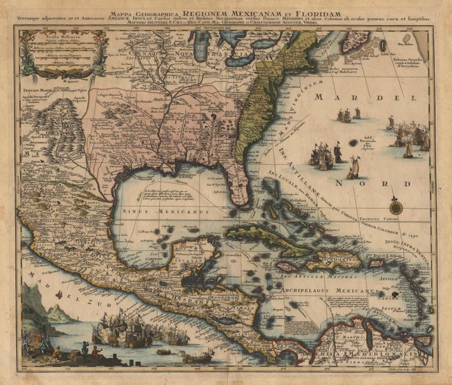
Subject: Colonial North America and Caribbean

Period: 1730 (circa)

Publication:

Color: Hand Color

Size:
22.7 x 18.7 inches
57.7 x 47.5 cm
Download High Resolution Image
(or just click on image to launch the Zoom viewer)

This is one of the many copies of Delisle's important map of 1703 (Carte du Mexique et de la Floride…). It provides a view of North America from the Great Lakes through the West Indies. The British colonies are confined east of the Appalachian Mountains, France controls the Mississippi Valley and Florida, and Spain possesses Mexico and New Mexico with political divisions as dictated by the Treaty of Utrect in 1713. While geographically nearly identical to Delisle's chart, this map is very decorative with both oceans filled with vignettes of raging sea battles. Engraved by Tobias Conrad Lotter, whose later issue of the map includes an inset replacing the naval battles in the Atlantic.

References: Martin & Martin, p. 93.

Condition: B

Lightly toned with a few spots in map and some marginal flaws.

Estimate: $1,500 - $1,700

Sold for: $950

Closed on 6/12/2002

Archived