Catalog Archive
Auction 99, Lot 121

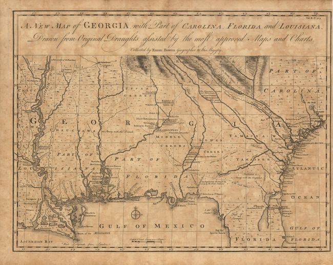
"A New Map of Georgia, with Part of Carolina, Florida and Louisiana", Bowen, Emanuel

Subject: Colonial South

Period: 1763 (published)

Publication: Harris' A Complete Collection of Voyages and Travels

Color: Black & White

Size:
18.7 x 14.2 inches
47.5 x 36.1 cm
Download High Resolution Image
(or just click on image to launch the Zoom viewer)

Scarce and important early map of colonial Georgia. The map covers from Charles Town to the Mississippi River and extends into Florida to C. Canaveral. The coastal settlements are well delineated, as are the Indian villages and forts (both French and English). The Indian tribes are noted as being friendly or hostile to the English. Major roads and trading paths are well depicted, many not found previously on a printed map. One of the interesting things about this map is that it was used in a 1981 Supreme Court battle over the location of the boundary between Georgia and South Carolina at the mouth of the Savannah River. This map was presented as evidence of Georgia's claim that the boundary lies on the northern bank of the river. First published in 1748, this being the second edition.

References: Cumming #267; TMC, Vol. 19, p.27-31.

Condition: A

Lightly toned. Close trimmed at right margin (1/8" - 1/4").

Estimate: $2,300 - $2,750

Sold for: $2,400

Closed on 6/12/2002

Archived