Catalog Archive
Auction 98, Lot 209

"Gray's New Map of Texas and the Indian Territory", Gray, O. W.

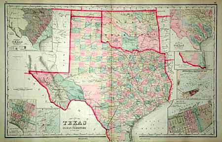
Subject: Texas and Oklahoma

Period: 1878 (circa)

Publication: The National Atlas

Color: Hand Color

Size:
25.7 x 16.1 inches
65.3 x 40.9 cm
Download High Resolution Image
(or just click on image to launch the Zoom viewer)

Terrific double page sheet filled with detail. The state's growth is evident with newly formed counties (here all 54 are present). Many railroads end between cities as the map shows the exact progress to date. Details include numerous named railroads, cities, towns, watershed, forts, springs, and much more. Seven large insets include city plans for Austin and Galveston, the Entrance to Galveston Bay, and the River Systems. Public Lands are limited to the western panhandle of Indian Territory. Great map of the states.

References:

Condition: A

Crisp impression and good coloring.

Estimate: $250 - $300

Sold for: $210

Closed on 3/6/2002

Archived