Catalog Archive
Auction 98, Lot 168

"Map Showing the progress of the Public Surveys in the Territories of Kansas and Nebraska", U.S. State Surveys

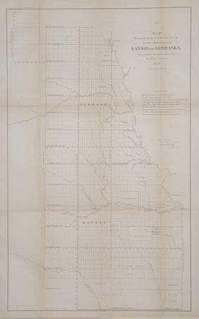
Subject: Kansas and Nebraska

Period: 1858 (dated)

Publication: Ward B. Burnett, Surveyor General

Color: Black & White

Size:
14.3 x 23.7 inches
36.3 x 60.2 cm
Download High Resolution Image
(or just click on image to launch the Zoom viewer)

Early survey chart with Indian lands, reservations and trusts clearly shown. Western line is well east of the present-day boundary. Early organization of townships with many blank or under contract for survey work, and roughly half marked as completed. Many Indian lands noted including Cherokee Neutral Lands, and reserves for various tribes: Osage, Sac and Fox, Kansas, Pottawattamie, Kickapoo, etc. All Indian areas are un-surveyed.

References: Baughman, pp. 72-3.

Condition: B

Age toned along folds with several clean splits reinforced with archival tape. Library stamp on verso.

Estimate: $60 - $100

Sold for: $45

Closed on 3/6/2002

Archived