Catalog Archive
Auction 98, Lot 161

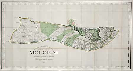
"Molokai. Primary Triangulation by W.D. Alexander and M.D. Monsarrat. Topography and Boundaries by M.D. Monsarrat. Map by F.S. Dodge, C.J. Willis and S.M. Kanakanui. Scale 1:60000. 1897.", Hawaii Territorial Surveys

Subject: Hawaii

Period: 1897 (dated)

Publication:

Color: Printed Color

Size:
48 x 25 inches
121.9 x 63.5 cm
Download High Resolution Image
(or just click on image to launch the Zoom viewer)

First edition of this large map produced by Alexander, the Surveyor-General. It is difficult to image a more detailed map of the island - topography, watershed, villages, land grants, coastal detail, lava flows, property owners, it's all here. A huge and fascinating map of this beautiful island.

References:

Condition: B

Great color and strong impression. Toned along some folds with several long split folds, most repaired on verso with archival tape, else very good.

Estimate: $150 - $200

Sold for: $130

Closed on 3/6/2002

Archived