Catalog Archive
Auction 97, Lot 315

"Reynold's Map of Modern London divided into Quarter Mile Sections", Reynolds, James
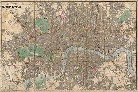
Subject: England

Period: 1862 (dated)

Publication:

Color: Hand Color

Size:
28.3 x 18.8 inches
71.9 x 47.8 cm
Download High Resolution Image
(or just click on image to launch the Zoom viewer)

Linen backed folding map in original embossed covers and marbled self-backs. Extends from Kentish Town to South Lambeth, Notting Hill to Limehouse. Hand colored postal district boundaries, principal streets, parks etc. Shows railway lines and terminals with the proposed railway to Liverpool Street .

References:

Condition: B

Some separations at fold intersections with a minor bit of paper loss. Inside advertising label torn. Covers rubbed but sound.

Estimate: $200 - $250

Sold for: $200

Closed on 12/5/2001

Archived