Catalog Archive
Auction 97, Lot 286

"Mappa Aestivarum Insularum, alias Barmudas Dictarum…", Montanus, Arnoldus
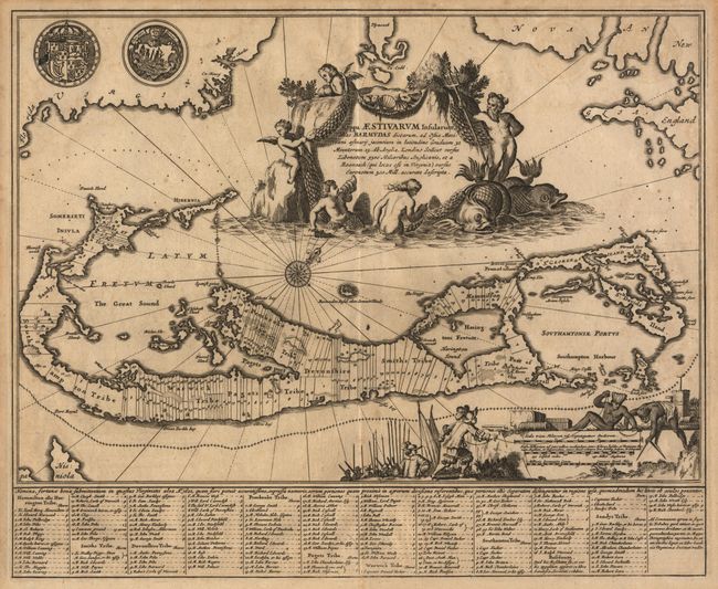
Subject: Bermuda

Period: 1671 (published)

Publication:

Color: Black & White

Size:
14 x 11.4 inches
35.6 x 29 cm
Download High Resolution Image
(or just click on image to launch the Zoom viewer)

The Dutch edition of Ogilby's 1670 English contribution to the mapping of the Bermudas. Basically similar in design to the Blaeu, but smaller and with updated Rococo cartouche and a more colonial scene around the scale of miles - natives in feather bonnets aid British colonists with surveying. Beautiful compass rose in ocean. The land is shown divided into nine large groups, each further subdivided into plots identified with the landholders name. Two decorative seals at upper left.

References: Margaret Palmer "No. 19 The Printed Maps of Bermuda"; Map Collector's Circle (London: 1965), No. 12.

Condition: B

On a nice sheet of hand laid paper with a beautiful and complex watermark. Lightly toned and some light scattered foxing.

Estimate: $1,000 - $1,200

Sold for: $650

Closed on 12/5/2001

Archived