Catalog Archive
Auction 97, Lot 249

"La Dominique situee entre la Martinique et la Guadeloupe…", Le Rouge, George Louis
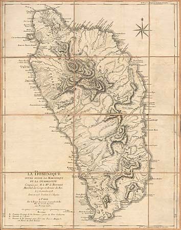
Subject: Dominica

Period: 1778 (dated)

Publication:

Color: Black & White

Size:
18.9 x 23.6 inches
48 x 59.9 cm
Download High Resolution Image
(or just click on image to launch the Zoom viewer)

Finely engraved sea chart highlighting the varied topography of Dominica. During the 18th century, the English and French fought for ownership of this island and the map focuses on this rivalry, locating three major battle sites. Large French style compass rose. Segmented and linen backed with vellum tab labeled in manuscript brown ink.

References:

Condition: A

Minor soiling, but overall fine condition for a working sea chart.

Estimate: $375 - $425

Sold for: $325

Closed on 12/5/2001

Archived