Catalog Archive
Auction 97, Lot 220

"A New and Accurate Map of the Province of Pennsylvania in North America, from the Best Authorities", Anon.

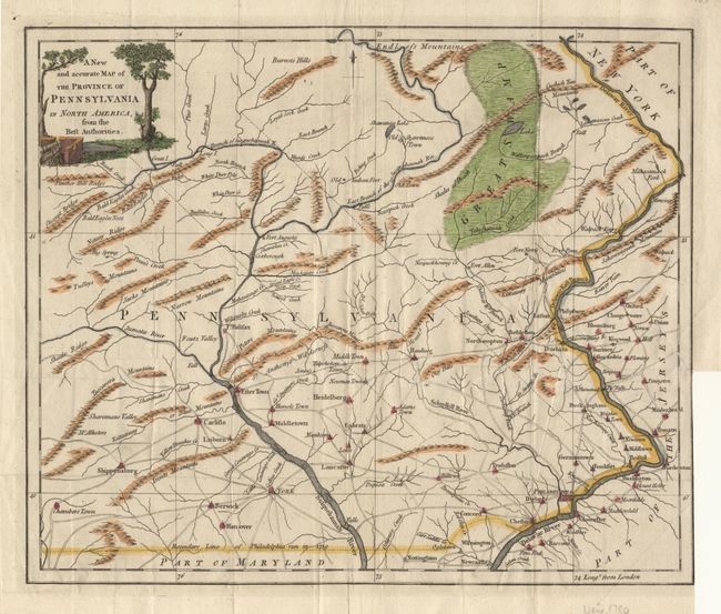
Subject: Pennsylvania

Period: 1780 (published)

Publication: Universal Magazine

Color: Hand Color

Size:
12.6 x 10.7 inches
32 x 27.2 cm
Download High Resolution Image
(or just click on image to launch the Zoom viewer)

Uncommon REVOLUTIONARY WAR period map depicting settlements and roads as well as topography. Extends as far west as "Chambers Town" in Pennsylvania and includes part of New Jersey. The "Boundary Line of Philadelphia run in 1730" divides Pennsylvania from Maryland. Decorative title cartouche with a fort and canon. Later color.

References: Jolly UNIV-185; Sellers and Van Ee #1298.

Condition: B

Binder's trim to neatline with small tear into border with tissue repair on verso. Folds as issued.

Estimate: $400 - $450

Sold for: $300

Closed on 12/5/2001

Archived