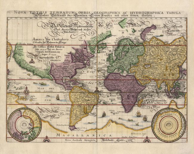
"Nova Totius Terrarum Orbis Geographica Ac Hydrographica Tabula", Merian, Matthaus
Subject: World
Period: 1646 (circa)
Publication:
Color: Hand Color
Size:
14 x 9.7 inches
35.6 x 24.6 cm
Beautifully engraved world map on Mercator's projection. The cartography was closely copied from Blaeu's world map of 1606. Latin title at top, outside neatline with German script title and notation concerning the discovering of the Americas in 1492 which discusses the unknown interior of North America. There is a large southern continent connected to New Guinea, California is a peninsula and there are plenty of open ended waterways in the eastern part of North America, which leave open the question of a Northwest Passage. Two polar projections in lower corners. The map is adorned with sea monsters, galleons and compass roses. This is the second state, lacking Merian's imprint.
References: Shirley #345.
Condition: A+
Fine impression. Small marginal tear, expertly repaired. Attractive later color.