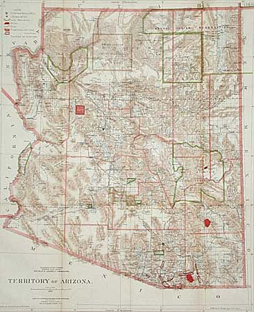
"Territory of Arizona", General Land Office
Subject: Arizona
Period: 1896 (dated)
Publication:
Color: Printed Color
Size:
16.8 x 20.4 inches
42.7 x 51.8 cm
A colorful General Land Office map with great detail. This is possibly the earliest GLO map of the Territory in color. It shows the extent of nine Indian Reservations and at least four Military reservations including Fort Apache. Indian reservations are outlined in green. Military reservations are shown in solid red. Private claims, confirmed and unconfirmed, are outlined in red. The Grand Canyon Reserve is shown. The brown hatchured mountain area and the blue waterways combine to provide great visual impact. Information includes watershed, mountains, railroads, wagon roads, private claims, unsurveyed townships, etc. A fascinating map of the territory that deserves much study.
References:
Condition: A
Very light toning along one fold, not distracting to the map. Folding as issued.