Catalog Archive
Auction 97, Lot 150

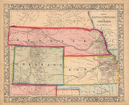
"Map of Kansas, Nebraska and Colorado", Mitchell, Samuel Augustus
Subject: Central United States

Period: 1860 (dated)

Publication: General Atlas

Color: Hand Color

Size:
14 x 11.3 inches
35.6 x 28.7 cm
Download High Resolution Image
(or just click on image to launch the Zoom viewer)

Mitchell's first edition of this map features Nebraska with a long panhandle extending all the way to Idaho. Names the PONY EXPRESS route. Locates numerous Indian tribes, forts and a trading post. County development in Kansas and Nebraska is limited to the eastern edge, with no counties at all in Colorado. Very well colored and a crisp, dark impression. A fine example of this map and a worthy companion to the next lot.

References:

Condition: A

A little edge toning and some small foxing spots just into upper border.

Estimate: $200 - $250

Sold for: $250

Closed on 12/5/2001

Archived