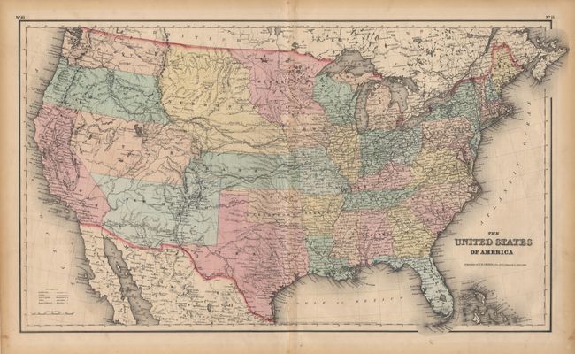
"The United States of America", Colton, Joseph Hutchins
Subject: United States
Period: 1855 (dated)
Publication:
Color: Hand Color
Size:
25 x 14.6 inches
63.5 x 37.1 cm
A great map of the United States with early western territorial boundaries. Minnesota includes most of present day North and South Dakota, with Nebraska taking in the rest of the region up to the Rocky Mountains. Kansas Territory (spelled Kanzas) borders Utah and New Mexico in the west. Washington and Oregon both extend eastward to the Rocky Mountains. Kansas' western boundary is with Utah and there is no Colorado. Utah and New Mexico are both shown in their largest configurations. Several exploration routes are shown, including Fremont, Marcy, and Kearney. Dated 1855, but most likely published in 1857.
References:
Condition: A
A bit of very insignificant light foxing. Marginal fold separation repaired with archival tape. Overall very good.