Catalog Archive
Auction 97, Lot 128

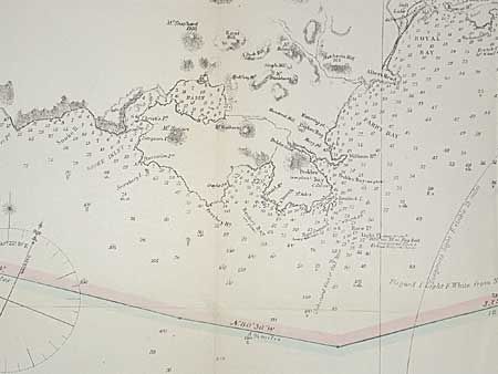
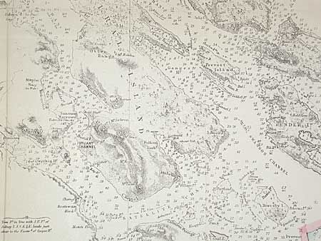
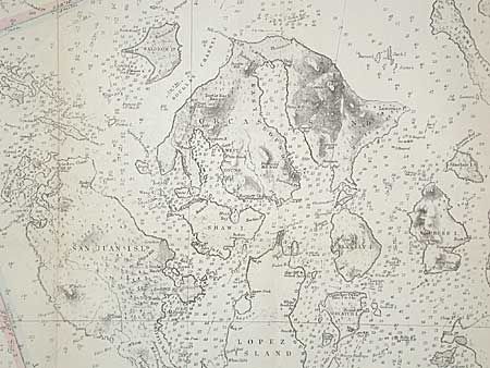
"Strait of Juan de Fuca and the channels between the Continent and Vancouver Id. showing the boundary line between British and American Possessions", U.S. Coast Survey

Subject: Northwestern United States and Canada

Period: 1872 (dated)

Publication:

Color: Hand Color

Size:
43 x 29 inches
109.2 x 73.7 cm
Download High Resolution Image
(or just click on image to launch the Zoom viewer)

From the Admiralty surveys by Capt. H. Kellett, R.N. 1847 and Capt. G.R. Richards, R.N. 1858-62. This map has a drawn-in line showing the U.S. Boundary claim at the final chapter of the U.S. - U.K. Boundary Dispute. The Kaiser, who ruled in favor of the U.S. claim, settled it in arbitration in 1872. Fine detail throughout the San Juan Islands and the Strait. A very historical map that is infrequently offered.

References:

Condition: B

Good impression and color. Toned along folds. Backed with archival tissue and pressed.

Estimate: $300 - $400

Sold for: $275

Closed on 12/5/2001

Archived