Catalog Archive
Auction 97, Lot 114

"Carte Du Canada ou de la Nouvelle France et des decouvertes qui y ont ete faites Dressee sur plusieurs Observations et sur un grand nombre de Ralations imprimees ou manuscrites", Delisle/Covens & Mortier
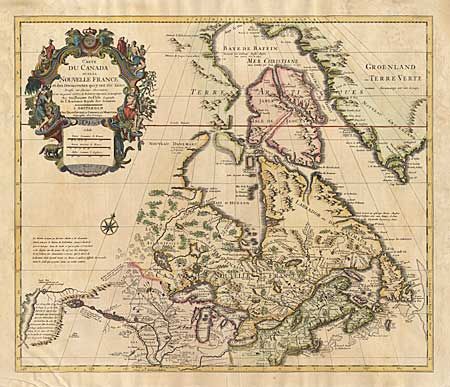
Subject: Colonial United States and Canada - Great Lakes

Period: 1730 (circa)

Publication:

Color: Hand Color

Size:
22.6 x 19.3 inches
57.4 x 49 cm
Download High Resolution Image
(or just click on image to launch the Zoom viewer)

First issued by Guillaume Delisle in 1703, this richly detailed map provides the most accurate rendering of the Great Lakes of the time, with the lakes fully enclosed and properly placed in longitude and latitude. The map is largely based on the surveys of Lahontan, Louis Hennepin, Jean Franquelin and Louis Jolliet. It depicts the "Longue River" stretching westward with a notation concerning the possibility of a passage to the Pacific. Large beautifully title cartouche.

References: Kershaw #318; Tooley (America), p. 20, #39.

Condition: A

Tiny bit of faint discoloration, mostly in margins. Backed with light Japanese tissue, overall very good.

Estimate: $800 - $900

Sold for: $800

Closed on 12/5/2001

Archived