Catalog Archive
Auction 97, Lot 100

"A Map of that part of America which was the Principal Seat of War, in 1756", Anon.

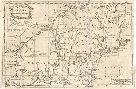
Subject: Colonial New England

Period: 1756 (dated)

Publication: Gentleman's Magazine

Color: Black & White

Size:
13 x 8.5 inches
33 x 21.6 cm
Download High Resolution Image
(or just click on image to launch the Zoom viewer)

The map covers the northeastern part of the present-day United States. It shows the areas which were the "Principal Seat" of the French & Indian War. A great deal of the conflict was focused around the upper Hudson and Lake Champlain, and the Mohawk River to Lake Ontario. Good detail with many placenames, rivers and lakes located and named. Several forts involved in the war are located, including William Henry, Frontenac, Edward, and Frederick. All these details and topographical information important to the contemporary reader following the war from across the Atlantic.

References: Jolly GENT-102.

Condition: C

Good impression on hand laid paper. Several tears within the map, all repaired except one small loss of paper affecting the C of Canada and filled with a patch. Archival tape on face of one tear. Would benefit from proper restoration.

Estimate: $100 - $150

Sold for: $100

Closed on 12/5/2001

Archived