Catalog Archive
Auction 96, Lot 95

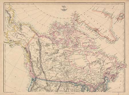
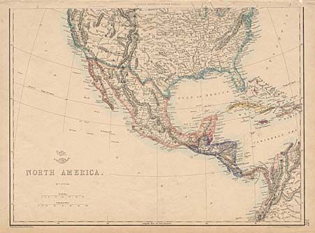
"North America", Ettling, Theodor

Subject: North America

Period: 1860 (circa)

Publication: Weekly Dispatch Atlas

Color: Hand Color

Size:
17 x 12.5 inches
43.2 x 31.8 cm
Download High Resolution Image
(or just click on image to launch the Zoom viewer)

Pair of maps (un-joined) making up the continent. States and territorial borders are shown and includes early territorial boundaries in the western United States: Washington, Oregon, Nebraska, Utah, New Mexico (with Arizona named in the southern region), Kansas, Minnesota and Indian Territory. Provinces are named in Canada, but not delineated. Good topographical detail throughout.

References:

Condition: A

Estimate: $150 - $180

Sold for: $120

Closed on 9/12/2001

Archived