Catalog Archive
Auction 96, Lot 82

"A Map of North America. With the European Settlements & whatever else is remarkable in ye West Indies, from the latest Observations", Seale, Richard William

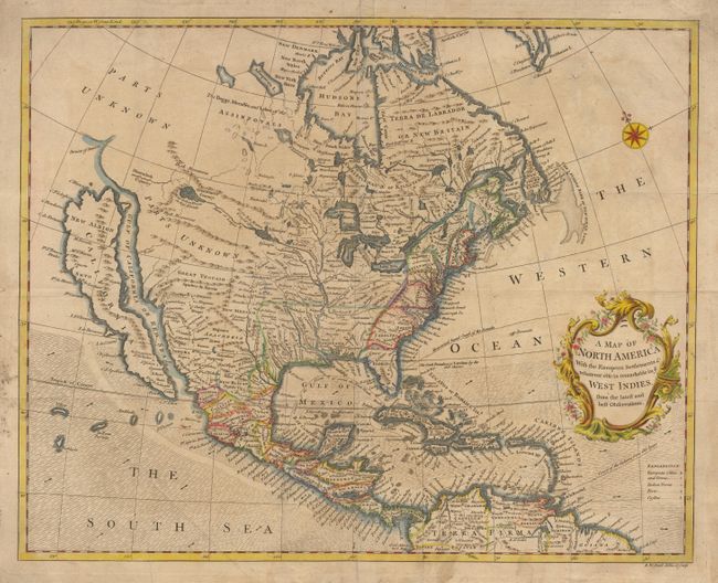
Subject: North America

Period: 1745 (circa)

Publication: Rapin de Thoyras' History of England

Color: Hand Color

Size:
18.2 x 14.7 inches
46.2 x 37.3 cm
Download High Resolution Image
(or just click on image to launch the Zoom viewer)

Attractive map based on Popple's seminal map of 1733. It is one of the last maps to show CALIFORNIA IS AN ISLAND although Seale apparently also incorporated some information from Kino in the Southwest. He also continued to portray fanciful details from Baron Lahontan's romantic tale of his 1688-90 travels west of the upper Mississippi River with the Longue River stretching to the Rocky Mountains. Notes the Straits of Anian, but most of the northwest is marked "Parts Unknown" and contains little data. The trade winds are designated by shading with directional arrows showing the course of the winds. The routes of the Spanish galleons are marked in the Caribbean. Includes an ornate title cartouche and compass rose. $1,400 RESERVE

References: McLaughlin #228; Tooley (America) #97, p. 134; Wheat (TMW) #124.

Condition: B

Lightly toned with a bit of minor soil. Tiny puncture hole near Greenland. Japanese tissue reinforced fold.

Estimate: $1,700 - $1,800

Sold for: $1,400

Closed on 9/12/2001

Archived