Catalog Archive
Auction 96, Lot 554

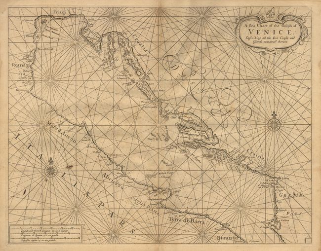
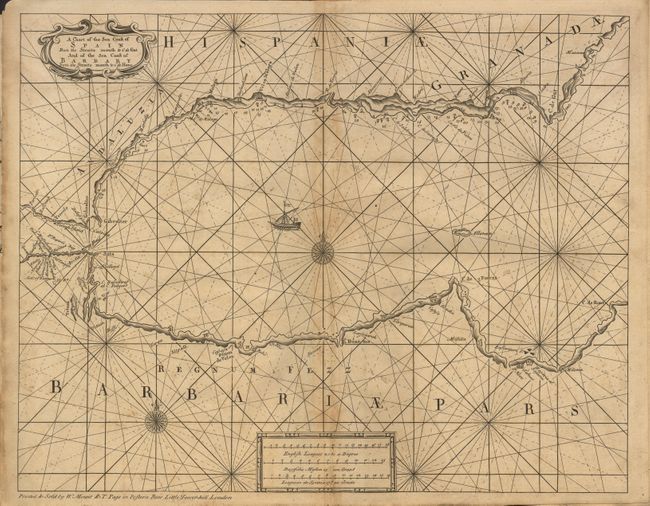
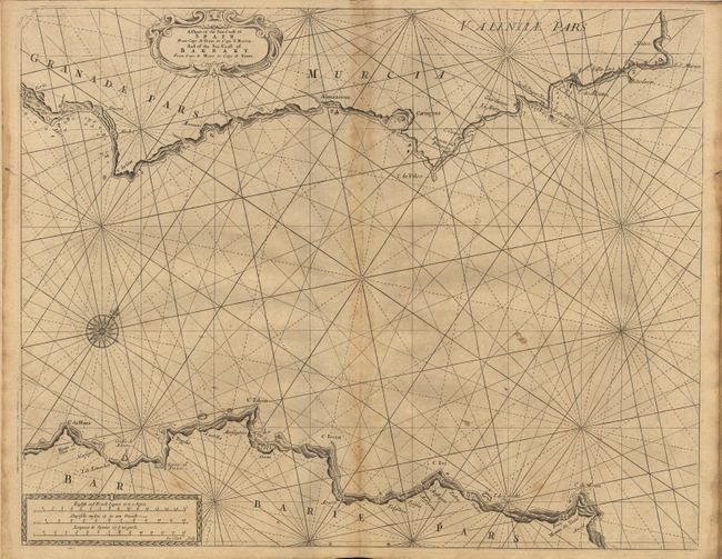
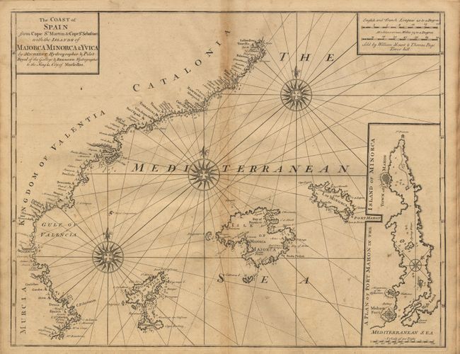
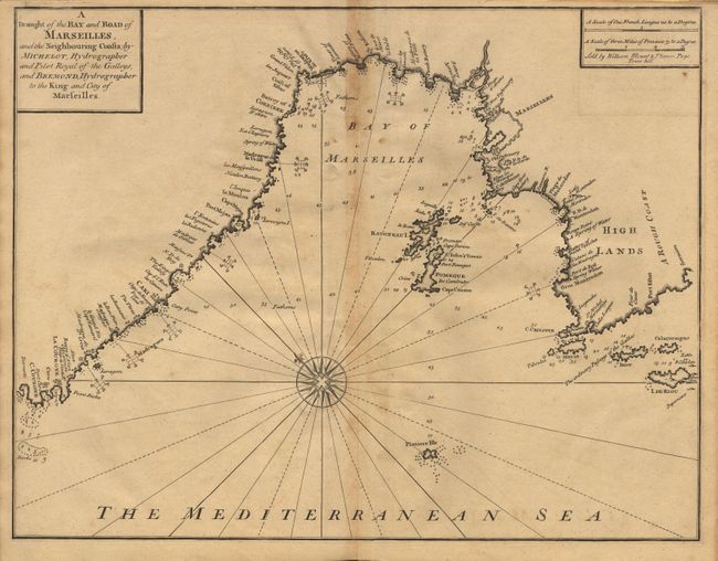
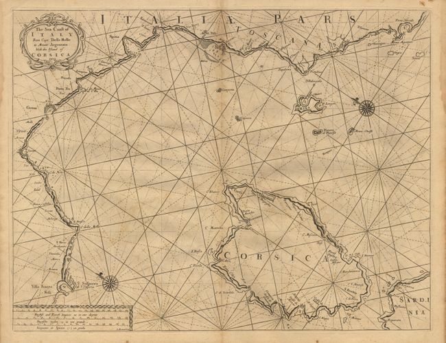
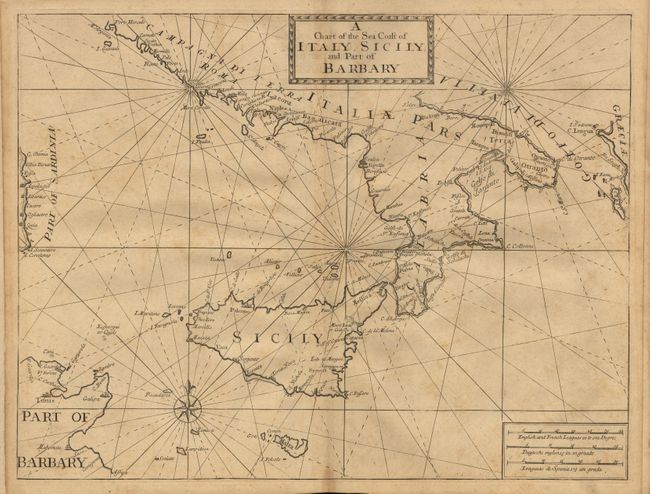
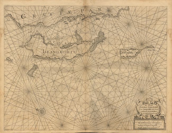
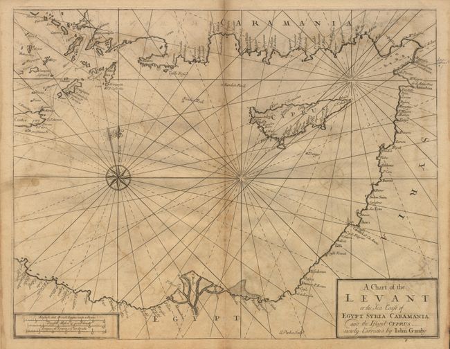
"The English Pilot. Part III. Describing the Sea-Coasts, Capes, Head-Lands, Bays, Roads, Harbours, Rivers and Ports, Together with the Soundings, Sands, Rocks, and Dangers in the Whole Mediterranean Sea…", Mount & Page

Subject: Atlas

Period: 1750 (dated)

Publication:

Color: Black & White

Size:
See Description
Download High Resolution Image
(or just click on image to launch the Zoom viewer)

A complete set of seventeen maps, with title page, lacking binding. Features a large (44 x 18.5") folding map titled "A Correct Chart of the Mediterranean Sea from the Coast of Portugal to the Levant." A beautiful, decorative map with large insets and multiple compass roses. The 16 other maps are double-page folio sheets covering parts of the Mediterranean and are all embellished with compass roses, rhumb lines, etc. Titles and condition defects as follows: "A Chart of the Sea Coast of Spain from the Straits mouth to C de Gat and the Sea Coast of Barbary from the Straits mouth to C de Hone"; "A Chart of the Straits of Gibraltar" (close trimmed with loss of neatline top & bottom); "A Chart of the Sea-Coast of Spain from Cape de Gata to Cape S. Martin and the Sea-Coast of Barbary from Cape de Hone to de Tenes"; "The Sea Coast of Barbary from Cape de Tenes to Cape de Rosa" (close trimmed at bottom touching neatline); "A Large Chart of Port Maon on the Island of Minorca on the Mediterranean" with the upper portion titled "Barcelona by John Gaudy" (close trimmed at top with loss of neatline); "The Coast of Spain from Cape St. Martin to Cape St. Sebastian with the Islands of Majorca Minorca & Yvica by Michelot, Hydrographer and Pilot Royal of the Galleys, and Bremond, Hydrographer to the King and City of Marseilles"; "The Sea Coast of Languedoc Provence, and part of Italy; from Cape Dragon to Cape Delle Melle" with a large inset "The Bay of Toulon"; "A Draught of the Bay and Road of Marseilles, and the Neighbouring Coast; by Michelot…"; "The Sea Coast of Italy From Cape Delle Melle to Mount Argentato with the Island of Corsica"; "A New Chart of the Islands of Corsica & Sardinia. By Michelot…& Bremond..."; "A Chart of the Sea Coast of Italy, Sicily; and Part of Barbary"; "A Sea Chart of the Gulph of Venice, Describing all the Sea Coasts and Islands contained therein"; "A Chart of the Islands Corfu, Pachfu and Antipachfu with ye Channel and Roads between the Island of Corfu & ye Graetian Coast"; "A Chart of the South Coast of Morea from Venetica to C S. Angelo with ye Islands of Serigo Serigoto and part of Candia" [and, on the same sheet] "A Chart of the South part of Cephalonia, with the Island of Zante and the Coast of Morea from C. Chiarefe, to C Sapienza" ; "A New Chart of the Archipelago Corrected by Jon. Gaudy" (close trimmed with loss to side neatlines); "A Chart of the Levant or the Sea Coast of Egypt Syria Caramania and the Island of Cyprus new Corrected by John Gaudy". This 1750 edition not listed in Phillips.

References: Phillips (A) 190 & 2805.

Condition: B

Missing covers and end papers, with no text pages present. All maps are on thick handlaid paper and in generally good condition, with some surface soiling.

Estimate: $3,500 - $4,500

Sold for: $2,500

Closed on 9/12/2001

Archived