Catalog Archive
Auction 96, Lot 252

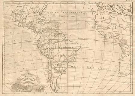
"Carte pour Servir a l'Histoire Philosophique et Politique des Etablissemens et du Commerce des Europeens dans les Deux Indes", Bonne, Rigobert
Subject: Atlantic Ocean

Period: 1780 (circa)

Publication:

Color: Black & White

Size:
18 x 12.7 inches
45.7 x 32.3 cm
Download High Resolution Image
(or just click on image to launch the Zoom viewer)

This interesting map focuses on the Atlantic Ocean and the trade routes between European and the Americas. It covers all of South America, a bit of North America, the West Indies and the eastern coast of Africa. Details rivers, major towns, and shows only New Orleans, St. Augustine and Santa Fe in U.S. The directions of trade winds are marked in the ocean along with the months of the year. Decorative title cartouche.

References:

Condition: A

Binding tear in margin with old paper repair, light impression.

Estimate: $100 - $150

Sold for: $85

Closed on 9/12/2001

Archived