Catalog Archive
Auction 96, Lot 210
"Description, Situation &c. Vue de la Ville de Mexique des duex Lacs sur Lesquels ellle est Batie, du Grand Temple de cette Ville des Sacrifices d'Hommes…", Chatelain, Henry Abraham
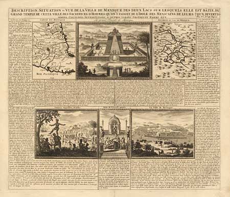
Subject: Mexico
Period: 1705 (circa)
Publication: Atlas Historique et Methodique
Color: Black & White
Size:
17 x 14.5 inches
43.2 x 36.8 cm
Download High Resolution Image
(or just click on image to launch the Zoom viewer)
(or just click on image to launch the Zoom viewer)