Catalog Archive
Auction 96, Lot 187

"Map Showing the Routes travelled by the Command of Majr E. Steen, U. S. Drags., against the Snake Indians in 1860", Dixon, Joseph (Lt)

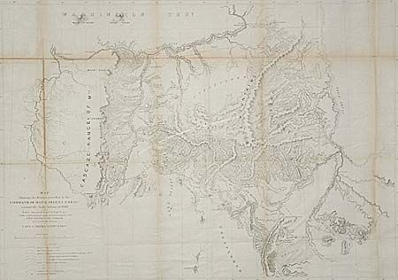
Subject: Oregon and Washington

Period: 1860 (published)

Publication: 37th Congress, 2nd Session, Sen. Ex Doc. No. 1

Color: Black & White

Size:
34 x 24.5 inches
86.4 x 62.2 cm
Download High Resolution Image
(or just click on image to launch the Zoom viewer)

Lithographed map (by J. Bien & Co.) on a scale of about 12 miles to the inch. Extensive and detailed map of the area east of the Deschutes River and extending to the Snake River, and from the desert southeast of Lake Harney to the Columbia River. The map represents a decisive campaign against the Shoshones, who were defeated during the campaign. It depicts many exploration routes, emigrant and Indian trails, camps, battle grounds, and forts.

References: Wheat (TMW) #1016.

Condition: B

Toned along some folds. Two small areas of loss at fold intersections, now backed with Japanese tissue for additional support.

Estimate: $150 - $250

Sold for: $250

Closed on 9/12/2001

Archived