Catalog Archive
Auction 96, Lot 158

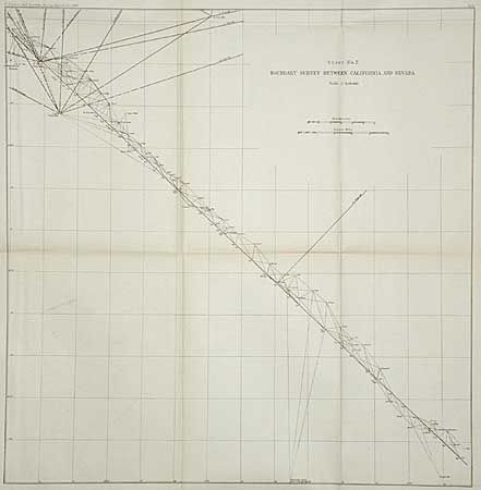
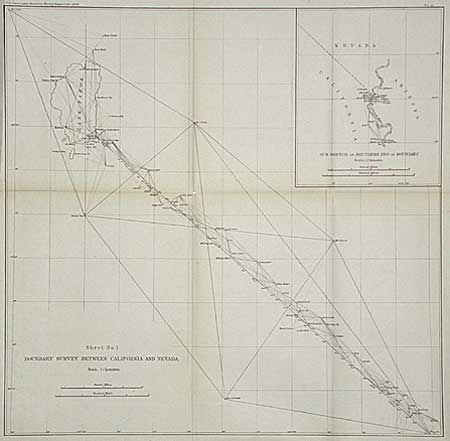
"Boundary Survey between California and Nevada (Sheet 1 & 2)", U.S. Coast & Geodetic Survey

Subject: California & Nevada

Period: 1896 (dated)

Publication:

Color: Black & White

Size:
See Description
Download High Resolution Image
(or just click on image to launch the Zoom viewer)

Fascinating pair of maps that together show, in minute detail, how the state line was determined. The boundary is referenced by triangulation to scores of reference points. Major points include the Mts. Conness, Grant, and Como, Telescope Peak, etc. Sheet No. 1 includes a large inset of the boundary along a short portion of the Colorado River. Two lithographed maps measuring 18 x 17.7" and 20.2 x 20.8".

References:

Condition: A

Faint toning on folds.

Estimate: $50 - $60

Sold for: $25

Closed on 9/12/2001

Archived