Catalog Archive
Auction 96, Lot 107

"Carte du Mexique et de la Floride des Terres Angloises et des Isles Antilles", Delisle/Covens & Mortier
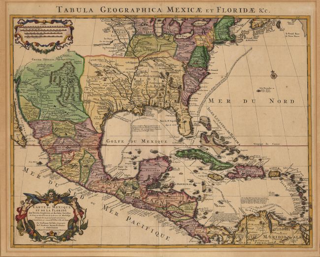
Subject: Colonial North America and Caribbean

Period: 1722 (dated)

Publication:

Color: Hand Color

Size:
23.5 x 18.5 inches
59.7 x 47 cm
Download High Resolution Image
(or just click on image to launch the Zoom viewer)

Based on Delisle's landmark map showing the correct delineation of the course and mouth of the Mississippi River. This great map covers nearly all of the present-day United States, Mexico, Central America and the Caribbean. It shows the explorations of d' Iberville on the Gulf Coast, the Indian villages and Spanish missions in East Texas, and the cities of Cibola in New Mexico. The route of the Spanish gold and silver fleets are shown in the Gulf of Mexico and the Caribbean.

References: Schwartz & Ehrenberg, p. 143; Wheat (TMW) I, p. 58, #84.

Condition: A

Very sharp impression and attractive later color. Mat burn in margins and on verso with remnants of brown paper tape along margins that have been trimmed for framing - none of which would be visible if re-framed.

Estimate: $1,400 - $1,500

Sold for: $1,200

Closed on 9/12/2001

Archived