Catalog Archive
Auction 96, Lot 102

"Pas-kaart Vande Zee Kusten inde Boght van Niew Engeland Tusschen de Staaten Hoek en C. de Sable…", Keulen, Johannes van

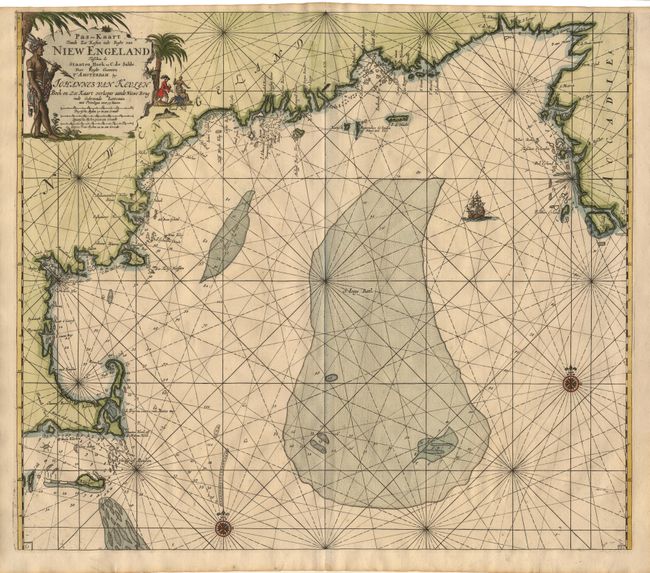
Subject: Colonial New England and Nova Scotia

Period: 1684 (circa)

Publication: Zee-Fakkel

Color: Hand Color

Size:
22.9 x 19.7 inches
58.2 x 50 cm
Download High Resolution Image
(or just click on image to launch the Zoom viewer)

An uncommon famous early sea chart showing the New England coast from Nantucket to Nova Scotia in considerable detail including both Plymouth and Boston harbors. This map is from the 4th part of Van Keulen's important and popular sea atlas, which was devoted to the Americas. Koeman calls the Van Keulen maps "of paramount importance in the development of marine cartography." The chart is beautifully engraved with a large decorative cartouche, sailing ship, compass roses and rhumb lines.

References: McCorkle #684.2; Koeman Vol. IV p.385 #136.

Condition: A+

Superb impression and condition.

Estimate: $4,000 - $4,500

Sold for: $4,000

Closed on 9/12/2001

Archived