Catalog Archive
Auction 96, Lot 101

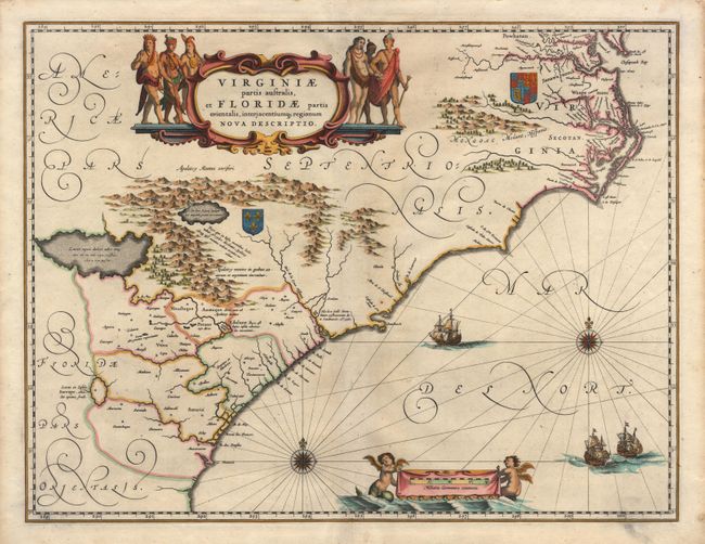
"Virginiae partis australis, et Floridae parties orientalis, interjacentiumq regionum Nova Descriptio", Blaeu, Willem
Subject: Colonial Southeast

Period: 1680 (circa)

Publication:

Color: Hand Color

Size:
20 x 15.2 inches
50.8 x 38.6 cm
Download High Resolution Image
(or just click on image to launch the Zoom viewer)

This striking map of the Southeast is based on the Mercator-Hondius map of 1606 with marked improvements in the northern part of the map, based largely on the work of Hessel Gerritsz. In the Chesapeake Bay area Newport News (Newport Nesa) is named for the first time, along with Bermouth, Stortingen and Arglas. The cartography in the southern part of the map remains unchanged with three imaginary lakes shown, the largest draining through the Carolinas via the May River. The map is adorned with a colorful cartouche showing six Indians in full regalia. Two coats of arms are placed to reflect the colonial interests of France and Britain. The Atlantic Ocean contains two compass roses, three sailing ships and two winged children of the sea holding the German scale of miles. No text on verso indicating this map is from an edition issued after the fire that destroyed the printing house and the subsequent death of Joan Blaeu in 1673. The copperplates were auctioned in 1677 and while the buyer is not recorded, the map does appear in atlases published by Frederic de Wit and Christopher Browne.

References: Burden #253.

Condition: A

A fine crisp impression with very attractive later color in the correct period style. Centerfold reinforced with Japanese tissue, but there is no apparent repair other than a tiny split in top margin.

Estimate: $1,900 - $2,100

Sold for: $1,400

Closed on 9/12/2001

Archived