Catalog Archive
Auction 95, Lot 91

"Carte de la Louisiane, Maryland, Virginie, Caroline, Georgie, avec une Partie de la Floride", Covens & Mortier

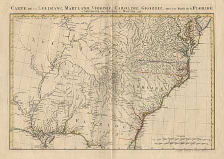
Subject: Colonial Southeast

Period: 1758 (dated)

Publication: Atlas Nouveau

Color: Hand Color

Size:
23.5 x 16.4 inches
59.7 x 41.7 cm
Download High Resolution Image
(or just click on image to launch the Zoom viewer)

Detailed map of the Southeast covering from Delaware Bay to St. Augustine and inland to include the Mississippi valley and Natchitoches. French 'Louisiane' occupies the country west of the Appalachians and the conflicting claims of Britain and Spain are shown in the region of Georgia and Florida. Numerous Indian villages are located throughout the map.

References: Sellers and Van Ee #1386.

Condition: A

Splits on centerfold both top and bottom, well away from the map, else fine.

Estimate: $900 - $1,000

Sold for: $650

Closed on 6/13/2001

Archived