Catalog Archive
Auction 95, Lot 59

"America Sive Novus Orbis Respectu Europaeorum Inferior Globi Terrestris Pars", Bry, Theodore de

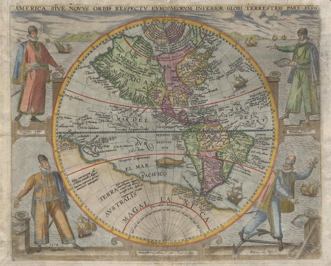
Subject: Western Hemisphere

Period: 1596 (circa)

Publication: Americae pars sexta sive historiae ab Hieronymo Bezono

Color: Hand Color

Size:
15.5 x 12.8 inches
39.4 x 32.5 cm
Download High Resolution Image
(or just click on image to launch the Zoom viewer)

This beautifully engraved map of the Americas is one of the most decorative of late 16th century maps and was to become a major influence in the elaborate style of the Dutch period. The map is largely derived from the Plancius world map of 1594 with an improved form of the Solomon Islands. Newfoundland is depicted as a single island based on the information of Cornelis Claesz and Lasso. Most significantly, this is the first Western Hemisphere map to incorporate the White - le Moyne cartography in Virginia. The massive southern continent is named Magellanica. The map is finely decorated with four important explorers flanking the map; Christopher Columbus, Amerigo Vespucci, Ferdinand Magellan and Francisco Pizarro, and a seascape background filled with sailing ships. A nice example of this important scarce map.

References: Burden #91.

Condition: A

Professionally and skillfully restored and backed with fine Japanese tissue, repairing centerfold including a tiny bit of infilled paper loss and facsimile of a couple of letters in the notation under the North Pole and in the imprint below the map.

Estimate: $8,000 - $9,000

Unsold

Closed on 6/13/2001

Archived