Catalog Archive
Auction 95, Lot 272

"Insulae et Regni Siciliae Novissima Tabula", Ottens
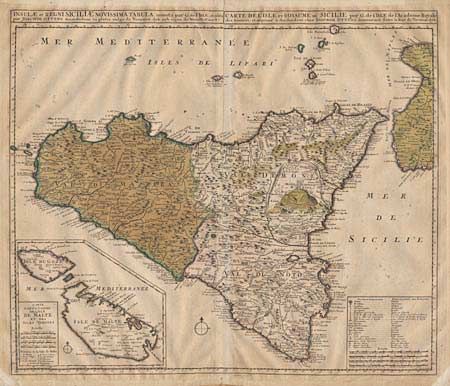
Subject: Italy

Period: 1750 (circa)

Publication:

Color: Hand Color

Size:
23.2 x 19.8 inches
58.9 x 50.3 cm
Download High Resolution Image
(or just click on image to launch the Zoom viewer)

Large, attractive map of Sicily based on the work of Guillaume de L'Isle. The island is fully engraved to show mountains, forests, lakes and rivers with Mt. Aetna prominently featured. Large inset 'Carte particuliere de l'Isle de Malte et des Isles Voisines' showing the strategically important Mediterranean Islands of Malta and Gozo. Table and scale of miles provides a key to the incredible detail on the map.

References:

Condition: D

Original color, quite faded and paper acidic with light spotting. Framers tape on verso which should be removed. Overall a crisp impression and a fine map worthy of the care of a professional conservator.

Estimate: $200 - $250

Sold for: $150

Closed on 6/13/2001

Archived