Catalog Archive
Auction 95, Lot 18
"Carta Hydrographica oder Algemeine Welt und Commercien Carte Warinnen die Grosse Meer und Seen, auch SeeKüsten, und fornehmbste Laender, der Gantzen Welt, neben denen Schiffarthen nach West und Oost Indien auch von dar zurucke, deutlich entworffen", Bodenehr, Gabriel
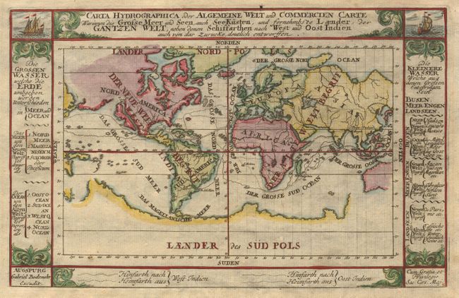
Subject: World
Period: 1700 (circa)
Publication:
Color: Hand Color
Size:
9 x 5.7 inches
22.9 x 14.5 cm
Download High Resolution Image
(or just click on image to launch the Zoom viewer)
(or just click on image to launch the Zoom viewer)