Catalog Archive
Auction 95, Lot 104

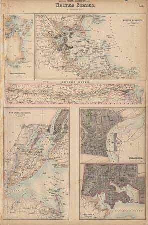
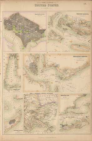
"[Lot of 2 - city plans]", Bartholomew, George

Subject: United States

Period: 1854 (circa)

Publication: Fullarton Atlas

Color: Hand Color

Size:
11.6 x 16.2 inches
29.5 x 41.1 cm
Download High Resolution Image
(or just click on image to launch the Zoom viewer)

Two maps providing terrific detail within 13 cities and harbors. The first is "Northern Ports & Harbours in the United States" which includes Portland (ME) Harbour, Boston Harbour and Vicinity, Hudson River, Philadelphia, New York Harbour and Vicinity, and Baltimore. The second is the "Southern Ports…" and includes Washington (DC), Beaufort Harbour (NC), Mobile Bay, Charleston Harbour, Galveston Entrance, Delta of the Mississippi & Environs of New Orleans, Pensacola Bay, and Key West Island.

References:

Condition: B

Just a few spots on first, light scattered foxing and short tear at top of latter sheet.

Estimate: $200 - $250

Sold for: $170

Closed on 6/13/2001

Archived