Catalog Archive
Auction 95, Lot 100

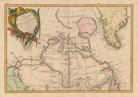
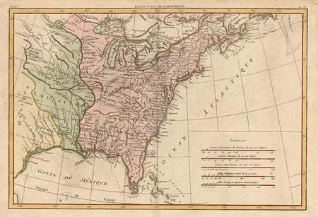
"[On two sheets] Partie de l'Amerique Septentrionale, qui comprend le Canada, la Louisiane, le Labrador, le Groenland, les Etats-Unis et la Floride", Bonne, Rigobert

Subject: United States and Canada

Period: 1783 (dated)

Publication: Lattre's Atlas Moderne

Color: Hand Color

Size:
17.1 x 11.6 inches
43.4 x 29.5 cm
Download High Resolution Image
(or just click on image to launch the Zoom viewer)

Finely engraved pair of maps covering the Eastern parts of North America. The first map covers eastern Canada and Greenland from the bottom of Hudson Bay, northward beyond the arctic Circle to about 70 deg. N. Latitude. It includes an interesting depiction of a passage between Lake Winnipeg and Hudson Bay alluding to a possible passage to the Pacific. The second map covers French 'Louisiane' and the newly formed United States with its western boundary on the Mississippi River. Nice detail, particularly of the French forts and Indian villages. Fine decorative title cartouche on first map.

References:

Condition: A

Nice impression and thick paper.

Estimate: $700 - $750

Sold for: $550

Closed on 6/13/2001

Archived