Catalog Archive
Auction 94, Lot 96

"A Topographical Map of Hudson's River … from Sandy-Hook … to Fort Edward, also the Communication with Canada by Lake George and Lake Champlain, as high as Fort Chambly on Sorel River", Sauthier/Faden

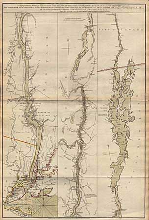
Subject: Colonial New York

Period: 1776 (dated)

Publication: North American Atlas

Color: Hand Color

Size:
20.7 x 31 inches
52.6 x 78.7 cm
Download High Resolution Image
(or just click on image to launch the Zoom viewer)

Important REVOLUTIONARY WAR period map showing the course of the river in strip map style from Fort Chambly to Staten Island. Extremely detailed to show towns and cities, roads, forts, connecting tributaries, falls, portages, bridges and soundings in New York Harbor and the lower Hudson River. It also shows the location of the site of the Battle of Long Island, and the location in Lake Champlain where the "Rebel Fleet were attacked on the 11th Oct. 1776". Original wash color in river with outline color distinguishing the boundary between New Jersey and New York.

References: Sellers and van Ee #1069, Tooley #23c, p. 64.

Condition: A+

Estimate: $3,500 - $4,000

Sold for: $3,500

Closed on 3/7/2001

Archived