Catalog Archive
Auction 94, Lot 248

"Letts's Map of London", Letts & Sons

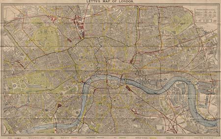
Subject: England - London

Period: 1887 (circa)

Publication:

Color: Printed Color

Size:
26 x 15.7 inches
66 x 39.9 cm
Download High Resolution Image
(or just click on image to launch the Zoom viewer)

Superb, linen-backed pocket map of London. The map covers from Kilburn to Hackneywick in the north and from Chelsea to Deptford in the south. Great detail of the roads, buildings, railways, post offices, parks, etc. Tables of population to 1881. Folds into cloth boards measuring a tiny 2 x 3", titled in gilt lettering, 'Letts's Waistcoat Pocket Map of London'. Complete with original ribbon.

References:

Condition: A+

Minor rubbing, overall very fine.

Estimate: $150 - $180

Sold for: $210

Closed on 3/7/2001

Archived