Catalog Archive
Auction 94, Lot 130

"Etats-Unis Region des Territoires", Dufour, Guillaume Henri

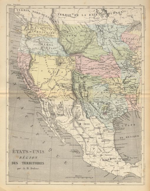
Subject: United States & Mexico

Period: 1860 (circa)

Publication: Atlas Populaire

Color: Hand Color

Size:
9.5 x 12.5 inches
24.1 x 31.8 cm
Download High Resolution Image
(or just click on image to launch the Zoom viewer)

Interesting French map of the western territories depicting several incorrect boundaries. "Nouveau Mexique" is shown with the approximate boundaries of the old Spanish territory. Utah encompasses all of present day Nevada, Utah, Colorado, Arizona and part of New Mexico, and its boundary with California lies along the Sierra Nevada. Nebraska Ty. occupies the region north of the Platte River and west to the Rocky Mountains. Kansas Ty. takes in present day Kansas, Nebraska and part of Colorado. To further confuse the map, the U.S./Mexican boundary reflects the Gadsden Purchase.

References:

Condition: A

Couple of very faint spots, still very good.

Estimate: $120 - $150

Sold for: $475

Closed on 3/7/2001

Archived