Catalog Archive
Auction 93, Lot 77

"Carte du Gouvernement de l'Amerique", Chatelain, Henry Abraham

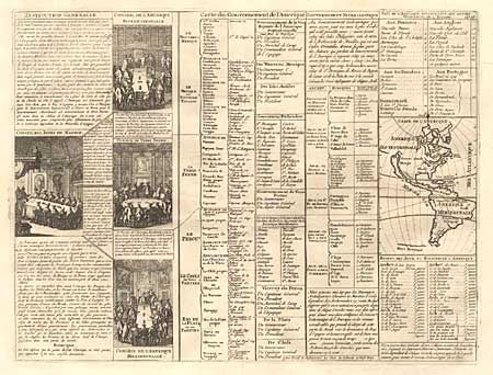
Subject: Western Hemisphere

Period: 1732-39 (published)

Publication: Atlas historique…

Color: Black & White

Size:
17.5 x 13.2 inches
44.5 x 33.5 cm
Download High Resolution Image
(or just click on image to launch the Zoom viewer)

Folio sheet filled with fascinating French text, statistics and 4 engravings showing various European councils dividing up the continents. The maps itself (3.7 x 5.2")shows an unnamed ISLAND OF CALIFORNIA, The only political detail is the division of the regions between the colonial powers. Far to the south, a purely speculative Antarctic continent is suggested as "Terre Inconnue".

References: McLaughlin #164.

Condition: A+

Crisp impression.

Estimate: $350 - $400

Sold for: $150

Closed on 12/6/2000

Archived