Catalog Archive
Auction 93, Lot 274

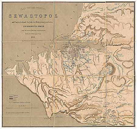
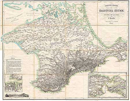
"Plan von der Festung Sevastopol [together with] Special-Karte der Halbinsel Krymm", Schropp & Handtke

Subject: Russia

Period: 1854 (dated)

Publication:

Color: Printed Color

Size:
See Description
Download High Resolution Image
(or just click on image to launch the Zoom viewer)

Pair of incredibly detailed Crimean War (1853-56) maps. (1) Plan of the fort of Sevastopol with surrounding area including military works of the allied forces, after the newest materials. This is a tinted lithograph, folding map, dissected and linen backed (20 x 20"). It shows the positions and constructions of the English, French, Turkish and Russian forces around Sevastopol and Baklava. (2) The Crimean Peninsula. This detailed map is also dissected and linen backed, consisting of 4 separate sections (total 24.5 x 31.5"). It includes a plan of Sevastopol and the surrounding military constructions and a small view of the city, the Telegraph Station, and the Russian forts Konstantine, St. Nicklas, Alexander and the Quarantine. On the map there is an explanation of the state of roads and paths and how people, animals and equipment may move around. Both maps fold into a sleeve, which fits in a marbled paper slipcase with gilt spine.

References:

Condition: A

Maps fine, slipcase with one tear and cello tape repair.

Estimate: $400 - $450

Sold for: $250

Closed on 12/6/2000

Archived