Catalog Archive
Auction 93, Lot 113

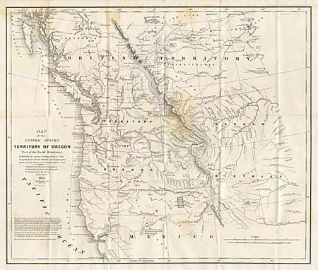
"Map of the United States Territory of Oregon West of the Rocky Mountains Exhibiting the vaious Trading Depots or Forts occupied by the British Hudson Bay Company connected with the Western and Northwestern Fur Trade", Abert/Hood

Subject: Western United States

Period: 1838 (dated)

Publication: U. S. War Dept.

Color: Black & White

Size:
20.5 x 17.3 inches
52.1 x 43.9 cm
Download High Resolution Image
(or just click on image to launch the Zoom viewer)

This map accompanied an important report intended to awaken public interest in the American occupation of Oregon Territory in the controversy with Great Britain, who also claimed the territory down to the Columbia River. Among the many interesting details are the locations of the various trading posts or forts connected with the northwestern fur trade, both American and British. The map covers present day Oregon, Washington, Idaho, Montana, and Wyoming. The region west of the Rocky Mountains is named Mandan District. It also shows much of southwestern Canada.

References: Wheat (TMW) #434.

Condition: B

Folding as issued. Some light staining, else very good.

Estimate: $350 - $400

Sold for: $275

Closed on 12/6/2000

Archived