Catalog Archive
Auction 92, Lot 44

"Poli Arctici, et Circumiacentium Terrarum Descriptio Novissima", Hondius
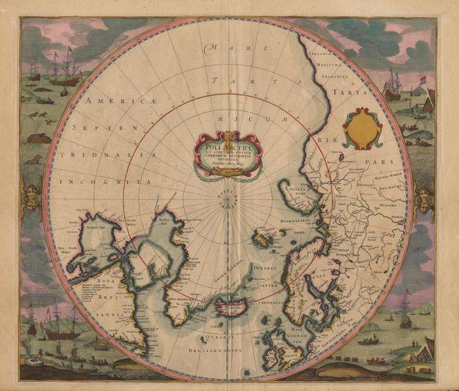
Subject: North Pole

Period: 1639 (published)

Publication: Nouvel Atlas

Color: Hand Color

Size:
19.5 x 17 inches
49.5 x 43.2 cm
Download High Resolution Image
(or just click on image to launch the Zoom viewer)

Hondius' important map of the polar region, which replaced Mercator's map and incorporated much of the knowledge gained by the English in their search for a Northwest Passage to Asia. The cartography is based on Henry Briggs' description of Hudson Bay. There are several Dutch names in Labrador, many appearing for the first time on this map. The fascinating whaling scenes surrounding the map also depict Dutch activity in the region. Strapwork title cartouche and a second blank cartouche are in this third state of the plate, the first to include the whaling scenes. From a French edition with the page number on verso. $2,200 RESERVE

References: Burden #246.

Condition: A+

Original color throughout. Couple of tiny tears in top margin, repaired with Japanese tissue, overall fine.

Estimate: $2,600 - $2,800

Sold for: $2,200

Closed on 9/13/2000

Archived