Catalog Archive
Auction 92, Lot 177

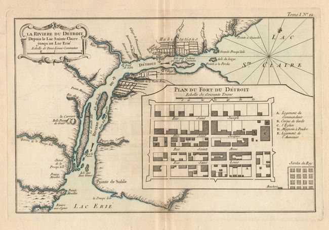
"La Riviere du Detroit, Plan du Fort du Detroit", Bellin, Jacques Nicolas

Subject: Michigan - Detroit

Period: 1764 (published)

Publication: Petit Atlas Maritime

Color: Hand Color

Size:
12.5 x 8 inches
31.8 x 20.3 cm
Download High Resolution Image
(or just click on image to launch the Zoom viewer)

This is the first separately printed map of Detroit. The village and fort are located on the Detroit River connecting "Lac St. Clarie" with "Lac Erie" with the surrounding farms and "Village des Outaouais". A large inset shows the fort with a key to the locations within the fortification. Decorative title cartouche and fleur-de-lys with outline color delineating the lakes and river.

References: Tooley (America), plt #114, p. 316; Sellers and Van Ee #777.

Condition: A+

Estimate: $850 - $950

Sold for: $1,500

Closed on 9/13/2000

Archived