Catalog Archive
Auction 92, Lot 165

"Johnson's Minnesota and Dakota", Johnson & Ward
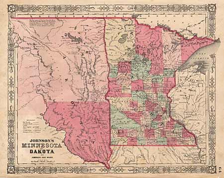
Subject: Dakota Territory and Minnesota

Period: 1864 (published)

Publication: New Illustrated Atlas

Color: Hand Color

Size:
15.5 x 12.5 inches
39.4 x 31.8 cm
Download High Resolution Image
(or just click on image to launch the Zoom viewer)

An attractive early map of Minnesota, six years after statehood showing 63 counties and early railroads shown. Numerous interesting notes, such as "The Vast Region of Prairie from Red River of North and Mini Walcan L. to about the Gr. Bend of the Missouri River is the Great Hunting Ground of Dakota, Ojibwe, Assiniboin, Arilcara, Minitarree and other Nations." Decorative border.

References:

Condition: B

Light foxing & surface soil. Few short tears at lower edge just touching border - repaired with archival tape.

Estimate: $50 - $60

Sold for: $0

Closed on 9/13/2000

Archived