Catalog Archive
Auction 92, Lot 139

"County Map of the States of Arkansas, Mississippi & Louisiana [together with] Arkansas, Mississippi and Louisiana",

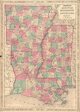
Subject: Southern United States

Period: 1864-72 (circa)

Publication:

Color: Hand Color

Size:
13.7 x 20.7 inches
34.8 x 52.6 cm
Download High Resolution Image
(or just click on image to launch the Zoom viewer)

Pair of attractive mid-nineteenth century maps, both covering the same region. First is by S.A. Mitchell (13.7 x 20.7") dated 1872, with his distinctive grapevine border. Second is by Johnson & Ward (17.5 x 24") circa 1864, also surrounded in an engraved border. Both are hand-colored by county. Roads and railroads are shown in great detail.

References:

Condition: B

The Mitchell map has a tiny fold separation just entering the grapevine border, repaired with archival tape. The Johnson map has a small chip at the centerfold, with a bit of loss in the border. Both are clean and bright.

Estimate: $60 - $80

Sold for: $160

Closed on 9/13/2000

Archived