Catalog Archive
Auction 92, Lot 128
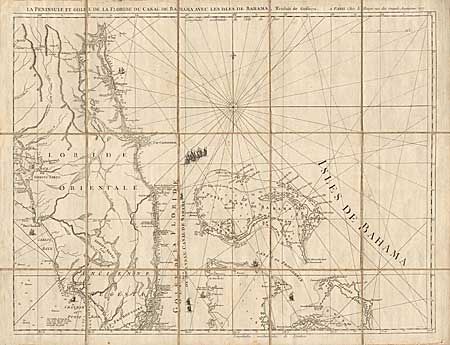
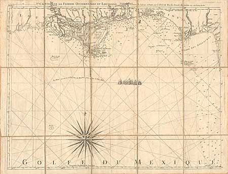
"Carte de la Floride Occidentale et Louisiana [together with] La Peninsule et Golfe de la Floride ou Canal de Bahama avec les Isles de Bahama, Traduit de Gefferys", Le Rouge, George Louis
1 of 2
Subject: Colonial United States
Period: 1777 (dated)
Publication: Pilote Américain Septentrional Pour les Cotes
Color: Black & White
Size:
26.2 x 20 inches
66.5 x 50.8 cm
Download High Resolution Image
(or just click on image to launch the Zoom viewer)
(or just click on image to launch the Zoom viewer)